


AI Satellite Object Detection: How Onboard Intelligence Is Reshaping Earth Observation for Benelux Operations
AI satellite object detection is the practice of running machine learning inference directly aboard an orbiting spacecraft — identifying, classifying, and flagging objects in imagery before that data ever reaches the ground. Instead of transmitting terabytes of raw pixels, the satellite sends structured alerts. Seventy percent of collected satellite imagery is never analyzed due to bandwidth constraints, per Satellite Industry Association data. Onboard AI changes that equation entirely.
This article is part of the broader cluster on applied AI for operational intelligence. You will find a practical, decision-ready breakdown of how onboard satellite AI works, what it costs, where it delivers measurable value for Benelux mid-market companies, and how to evaluate whether your organization should act now or wait.
Table of Contents
- Why This Matters Now
- How Onboard AI Inference Actually Works
- The Detect-and-Downlink Economics
- AI Satellite Object Detection in Logistics and Agriculture
- The Orbit-to-Outcome Playbook: A Decision Framework
- Hardware Realities: What Nobody Tells You About Edge AI in Space
- Benelux Opportunity: Subsidies, Programs, and Local Anchors
- Key Takeaways
- Frequently Asked Questions
Why This Matters Now
The satellite industry is no longer a niche technology story — it is infrastructure at scale, and the companies capturing its value are those treating geospatial data as an operational input, not a research curiosity. For Benelux mid-market companies, the window to build that capability at manageable cost is open now. Regulatory, funding, and constellation conditions converge in 2025–2026 in ways that will not repeat.
2,781 commercially-procured satellites were launched in 2023 alone — 456 more than the year before, per the Satellite Industry Association’s 2024 State of the Satellite Industry Report. The global commercial satellite industry generated $285 billion in revenue that year.
The market trajectory is steep. McKinsey’s Technology Trends Outlook 2025 projects the global satellite market will reach seven times its current size. Advanced connectivity — including low-Earth orbit (LEO) satellite networks — attracted $44.2 billion in equity investment by 2024. The bottleneck is no longer launch capacity or orbital slots.
The bottleneck is data.
Satellites collect far more imagery than ground systems can process. Edge processing in space can reduce satellite-to-ground transmission volumes by over 90%, per IEEE Geoscience and Remote Sensing research. That single figure reframes the entire business model of Earth observation: from raw data delivery to actionable intelligence delivery.
For Benelux companies, the opportunity is concrete. The Netherlands’ space sector contributes approximately €1.9 billion to the national economy, with over 80% of active space companies specializing in downstream data applications, per the Netherlands Space Office. In Belgium, the space industry generates €350 million in annual turnover, with Flanders-based companies receiving VLAIO funding to integrate AI into Earth observation for precision agriculture and North Sea maritime monitoring.
Regulatory tailwinds reinforce the urgency. The EU AI Act classifies certain Earth observation AI applications — particularly those affecting critical infrastructure — as high-risk systems requiring conformity assessments. Companies building or procuring satellite AI capabilities today need to design for compliance from the outset, not retrofit it later.
Source: Satellite Industry Association, 2024
How Onboard AI Inference Actually Works
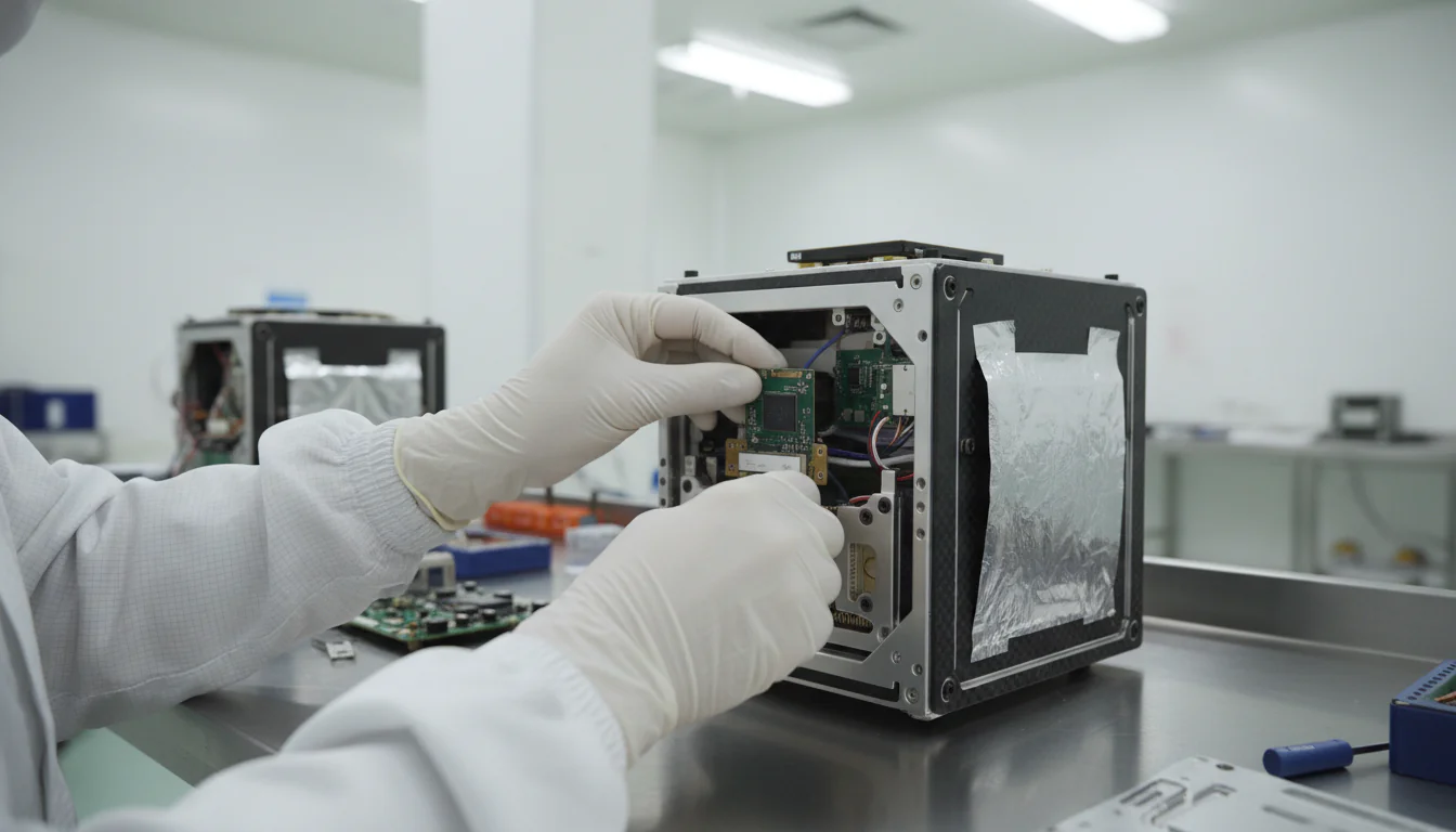
Onboard AI inference means the satellite’s processor runs a trained neural network model against raw sensor data in real time, producing structured outputs — bounding boxes, class labels, confidence scores — rather than raw imagery. A ship detection model on a 6U CubeSat, for example, can process a 20,000 × 20,000 pixel scene in under 30 seconds and downlink only the 40 vessel detections it found, not the full image.
The hardware stack matters enormously. Traditional satellite processors prioritized radiation hardness over computational throughput — a legitimate engineering constraint. Modern onboard AI relies on radiation-tolerant versions of commercial AI accelerators: NVIDIA Jetson modules, Intel Myriad X vision processing units, and purpose-built chips from companies like Ubotica and Unibap. Deloitte’s 2025 semiconductor outlook flags generative AI accelerator chips for the enterprise edge as a defining trend, and space-grade variants are entering the market on the same cycle.
The model pipeline follows a familiar computer vision architecture. A convolutional neural network (CNN) or transformer-based detector ingests multispectral or synthetic aperture radar (SAR) data. The model was trained on ground-based GPU clusters using labeled satellite imagery datasets. ESA’s benchmark for anomaly detection in satellite telemetry, published on arXiv in 2024, demonstrates the sophistication of these evaluation frameworks. Once trained, the model is compressed using quantization and pruning to fit within the satellite’s power and memory envelope, then uploaded via ground station command.
Three outputs are possible, and the choice determines the entire downstream workflow:
- Alert-only: The satellite downlinks a structured message — “3 vessels detected at coordinates X, Y, Z at timestamp T.” Minimal bandwidth, maximum latency reduction.
- Chip-and-ship: The satellite crops a small tile around each detected object and downlinks the tile plus metadata. Preserves visual evidence for human review.
- Full scene with annotations: The satellite downlinks the complete image with detection overlays. Bandwidth-intensive but retains the most analytical flexibility.
The choice between these modes is a business decision, not a technical one. It depends entirely on your decision window — the time between “data available” and “decision must be made.”
The Detect-and-Downlink Economics
Switching from raw-imagery downlink to onboard AI satellite object detection typically reduces ground-processing costs by 60–80% on high-revisit missions, while cutting analyst time by a comparable margin. The tradeoff is higher upfront hardware and model development costs — often €150,000–€400,000 per mission for the AI payload integration alone.
Here is the honest part: the economics are not universally favorable. High-performance AI chips in vacuum environments increase satellite thermal management complexity by approximately 40%, per IEEE Geoscience and Remote Sensing analysis. That cost is real and often underestimated in vendor proposals.
The comparison framework below makes the tradeoffs explicit:
| Workflow | Operational Cost | Analyst Time | Latency to Insight | Upfront AI Cost |
|---|---|---|---|---|
| Raw downlink → ground processing | High | High | Hours to days | Low |
| Onboard detection → chip-and-ship | Low | Medium | Minutes | High |
| Onboard detection → alert-only | Minimal | Low | Under 5 minutes | High |
| Hybrid (onboard triage + selective downlink) | Medium | Low | Minutes to hours | Medium-High |
The hybrid model — onboard triage with selective full-scene downlink — consistently outperforms pure strategies in mid-market use cases. It preserves analytical flexibility while capturing most of the bandwidth savings.
What we consistently see across implementations is that companies underestimate the value of reduced analyst time relative to bandwidth savings. A logistics company monitoring 12 port terminals across Northern Europe might employ 4–6 imagery analysts today. Onboard AI satellite object detection can reduce that headcount requirement by 60%, with the remaining analysts handling exception review rather than routine scanning.
Source: Veralytiq analysis based on ESA and IEEE published data, 2024
AI Satellite Object Detection in Logistics and Agriculture
AI satellite object detection delivers measurable value in two Benelux-relevant sectors: port logistics (vessel and container tracking) and precision agriculture (crop stress detection, field boundary mapping). Enterprises using high-frequency geospatial AI insights can achieve 15–25% reductions in supply chain operational costs by identifying bottlenecks before they appear in ground-level reporting, per Accenture research.
Consider a Rotterdam-based logistics operator managing 200 vessels across 8 terminals. Today, imagery analysts review satellite passes every 6–12 hours. With onboard AI satellite object detection, vessel alerts arrive within minutes of a satellite overpass. Berth occupancy data feeds directly into scheduling systems. The Port of Rotterdam is already deploying AI for vessel tracking and anomaly detection in sensor data — the infrastructure assumption is being validated at scale.
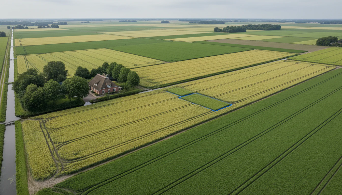
The agricultural application is structurally similar but operationally different. A 500-hectare arable farm in Zeeland or the Flevopolder receives weekly Sentinel-2 imagery through the Netherlands National Satellite Data Portal, managed by the Netherlands Space Office. Onboard AI object detection on next-generation satellites will shift that cadence from weekly to daily, with crop stress alerts delivered as structured data rather than raw imagery requiring specialist interpretation.
Key use cases by sector:
| Sector | Detection Target | Decision Window | Estimated Value Driver |
|---|---|---|---|
| Port logistics | Vessel position, berth occupancy | 30–120 minutes | Reduced idle time, optimized scheduling |
| Precision agriculture | Crop stress, field boundary change | 24–72 hours | Early intervention, yield protection |
| Maritime domain awareness | Vessel AIS discrepancy, dark shipping | Under 60 minutes | Compliance, insurance risk reduction |
| Infrastructure monitoring | Construction change, flood extent | 6–24 hours | Asset protection, regulatory reporting |
The global space economy is projected to reach $1.8 trillion by 2035, with the Data and Connectivity segment growing at a 10% CAGR, per World Economic Forum and McKinsey analysis. The downstream beneficiaries of that growth are companies in logistics, agriculture, and infrastructure monitoring — sectors heavily represented in the Benelux mid-market.
Want to understand how satellite-derived geospatial data fits your operational workflow? The operational intelligence solutions page outlines how Veralytiq structures geospatial AI engagements for mid-market companies.
The Orbit-to-Outcome Playbook: A Decision Framework
The Orbit-to-Outcome Playbook is a four-step framework for evaluating whether onboard satellite AI creates measurable financial advantage for your organization. It maps your geospatial decision latency requirements against the cost structure of detect-and-downlink workflows, producing a go/wait/partner recommendation.
Step 1 — Latency-to-Value Mapping. List every geospatial-dependent decision your organization makes. For each, quantify the “decision window”: the time between “data available” and “decision must be made” where acting earlier changes revenue, cost, or risk. A vessel arrival alert that is 4 hours late costs nothing if berth scheduling updates run daily. The same alert costs €15,000 if a ship idles at anchor for 6 hours.
Step 2 — Detect-and-Downlink Economics. Model your current workflow costs: bandwidth fees, cloud compute, storage, analyst salaries, and vendor subscriptions. Then model the onboard AI alternative: hardware amortization, model development, ground station integration, and residual analyst time. The crossover point — where onboard AI becomes cheaper — typically occurs when your organization consumes more than 500 GB of raw imagery per month or employs more than 2 full-time imagery analysts.
Step 3 — Workflow Re-Architecture. Map how AI-generated alerts and detections will flow into existing operational systems. This is where most projects stall. The satellite delivers a detection. Who receives it? In what format? Which system acts on it? A detection that lands in an email inbox does not reduce decision latency. A detection that triggers an API call to your TMS or ERP does.
Step 4 — Build, Buy, or Subscribe. Three viable paths exist for Benelux mid-market companies:
| Path | When to Choose | Typical Cost Range | Time to Value |
|---|---|---|---|
| Subscribe to AI-processed feeds | Need speed, limited internal capability | €20K–€80K/year | 4–8 weeks |
| Integrate via API (e.g., Planet, Airbus) | Need customization, have data team | €50K–€150K setup | 3–6 months |
| Commission custom onboard payload | Mission-critical latency, high volume | €400K–€2M | 18–36 months |
The pattern across client engagements is clear: most mid-market companies in the €5M–€100M revenue range should start with subscription or API integration, not custom payload development. The custom path is appropriate only when the latency-to-value mapping in Step 1 reveals a decision window under 30 minutes that cannot be served by existing commercial constellations.
Hardware Realities: What Nobody Tells You About Edge AI in Space
Running AI satellite object detection in orbit is not the same as running it in a data center — or even on a terrestrial edge device. Three physical constraints define what is possible: thermal dissipation in vacuum, radiation-induced performance degradation, and power budget limits that govern every inference window. Understanding these constraints before scoping a project is the difference between a realistic mission design and an expensive surprise.
62% of organizations are at least experimenting with AI agents, per McKinsey’s 2025 State of AI survey. In the satellite context, AI agents that autonomously decide what to downlink represent a significant shift in mission architecture — one that comes with engineering constraints vendor brochures consistently understate.
Start with thermal physics. Space is a vacuum. Heat generated by an AI accelerator chip cannot convect away — it must radiate. High-performance AI chips in vacuum environments increase satellite thermal management complexity by approximately 40%, per IEEE Geoscience and Remote Sensing research. This translates directly to mass, power budget, and mission cost.
The radiation environment degrades chip performance over time. Commercial AI accelerators are not designed for the ionizing radiation flux at 500–600 km altitude. Radiation-tolerant variants exist but operate at reduced clock speeds — typically 30–50% of their terrestrial performance specification. A model that runs at 45 frames per second in the lab may process 18 frames per second in orbit.
Power budgets are the binding constraint on most small satellite missions. A 6U CubeSat typically has a 10–20W power budget. A modern AI accelerator draws 5–15W under inference load. Running continuous inference on a CubeSat is physically impossible — the satellite must prioritize inference windows based on ground track, target areas, and battery state.
None of this is an argument against onboard AI satellite object detection. It is an argument for realistic mission design. ESA’s benchmark work on anomaly detection in satellite telemetry — published on arXiv in 2024 — demonstrates that purpose-designed lightweight models achieve detection accuracy within 3–5% of full-scale ground-processed results while fitting within these hardware envelopes.
Considering AI infrastructure for your operations? The AI automation solutions page covers how Veralytiq structures edge AI deployments — including the data pipeline architecture that makes satellite-derived detections operationally useful.
Benelux Opportunity: Subsidies, Programs, and Local Anchors
The Netherlands and Belgium offer substantive funding mechanisms for companies integrating AI satellite object detection into Earth observation workflows. Knowing which programs apply before scoping a project can reduce net project cost by 30–45% — a difference that frequently determines whether a business case clears internal approval thresholds.
The Netherlands and Belgium offer funding mechanisms that apply directly to AI satellite object detection projects. Understanding these programs before scoping a project can reduce net project cost by 30–45%.
WBSO (Wet Bevordering Speur- en Ontwikkelingswerk) covers R&D wage costs for Dutch companies developing novel AI models, including satellite image processing pipelines. Eligible activities include training custom object detection models on satellite imagery, developing onboard inference optimization techniques, and integrating geospatial AI outputs into operational systems. The subsidy covers 32% of R&D wages for the first €350,000 of qualifying costs, and 16% above that threshold.
MIT (Mkb-Innovatiestimulering Regio en Topsectoren) supports collaborative R&D projects between SMEs and knowledge institutions. Satellite AI projects with a university partner — TU Delft’s Space Systems Engineering group, for instance — qualify for up to €350,000 in project funding under the High Tech Systems & Materials topsector.
VLAIO in Belgium provides innovation subsidies covering 25–45% of eligible project costs for Flemish companies. Precision agriculture and maritime monitoring applications using AI satellite object detection are explicitly within scope of current VLAIO priority areas.
The local anchor for both countries is the Copernicus program. Sentinel satellite data is free, open-access, and updated every 5 days at 10-meter resolution. The ESA Copernicus Data Space Ecosystem provides direct access for European organizations. Building AI satellite object detection pipelines on Copernicus data eliminates the largest variable cost in most mid-market geospatial AI projects: imagery acquisition.
Europe’s private space employment grew 66% over the last decade, per the Space Foundation’s Q3 2024 report. That talent pool — concentrated in the Netherlands, Belgium, and Luxembourg — represents a hiring and partnership opportunity that did not exist five years ago.
Subsidy eligibility at a glance:
| Program | Country | Coverage | Max Benefit | Eligible AI Activity |
|---|---|---|---|---|
| WBSO | Netherlands | R&D wages | 32% up to €350K | Model training, inference optimization |
| MIT | Netherlands | Project costs | €350K | University-partnered satellite AI R&D |
| VLAIO Innovation | Belgium (Flanders) | Project costs | 25–45% | Agri and maritime AI applications |

Veralytiq has guided Benelux mid-market companies through applied AI implementations across logistics, manufacturing, and data-intensive operations — including geospatial AI projects that have cleared WBSO and MIT funding approval. If your organization is evaluating satellite-derived intelligence as an operational input, a focused introductory meeting is the fastest way to determine whether the economics work for your specific use case. From Data to Done.
Key Takeaways
- Onboard AI satellite object detection reduces data transmission volumes by over 90%, addressing the core bottleneck that leaves 70% of satellite imagery unanalyzed. [Satellite Industry Association, 2024; IEEE Geoscience and Remote Sensing]
- The global satellite market is projected to grow 7x, with the Data and Connectivity segment expanding at 10% CAGR through 2035 — downstream AI applications capture the majority of that value. [McKinsey Technology Trends Outlook 2025; World Economic Forum / McKinsey, 2024]
- Thermal management and power budget constraints are the binding hardware limits — AI chips in vacuum environments face ~40% greater thermal complexity, requiring purpose-designed lightweight models. [IEEE Geoscience and Remote Sensing]
- Benelux companies can reduce net project costs by 30–45% using WBSO, MIT, and VLAIO subsidies when developing satellite AI integration projects. [RVO.nl; VLAIO.be]
- Most mid-market companies should start with subscription or API-based access to AI-processed satellite feeds, not custom payload development — the Orbit-to-Outcome Playbook Step 4 maps the decision criteria clearly.
- EU AI Act compliance must be designed in from the start — high-risk classification for critical infrastructure monitoring applications requires conformity assessments, technical documentation, and human oversight mechanisms before deployment.
Frequently Asked Questions
What is the difference between onboard satellite AI and ground-based satellite image processing?
Onboard satellite AI runs inference directly on the spacecraft’s processor, producing structured outputs before data reaches the ground. Ground-based processing receives raw imagery and analyzes it in cloud or on-premise systems. Onboard processing reduces latency from hours to minutes and cuts downlink bandwidth by 60–90%, but requires higher upfront hardware investment.
How accurate are AI object detection models running on satellite hardware?
Purpose-designed lightweight models running on radiation-tolerant satellite processors typically achieve detection accuracy within 3–5% of full-scale ground-processed results, per ESA benchmark research published in 2024. Accuracy depends on model architecture, training data quality, and the spectral bands available on the specific satellite sensor.
Which industries benefit most from near-real-time satellite object detection?
Port logistics, precision agriculture, maritime domain awareness, infrastructure monitoring, and insurance are the five sectors where decision windows are short enough to justify the premium of onboard AI satellite object detection. Companies in these sectors face decisions — berth scheduling, crop intervention, vessel tracking — where 30-minute-old data is materially more valuable than 6-hour-old data.
What does it cost a mid-market company to start using AI-processed satellite data?
Subscription-based access to AI-processed satellite feeds (vessel detections, crop stress indices, building change alerts) typically costs €20,000–€80,000 per year. API-based custom integration with providers like Planet or Airbus Defence & Space runs €50,000–€150,000 in setup costs. Custom onboard AI payload development starts at €400,000 and is rarely appropriate for companies below €100M revenue.
How does the EU AI Act affect satellite object detection systems?
The EU AI Act classifies AI systems used for critical infrastructure monitoring — including port operations, energy grid surveillance, and certain agricultural applications — as high-risk. High-risk classification requires conformity assessments, technical documentation, human oversight mechanisms, and registration in the EU database before deployment. Companies procuring AI-processed satellite services should require vendors to provide AI Act compliance documentation.
Can Copernicus Sentinel data be used to build custom AI detection models?
Yes. Copernicus Sentinel data is free and open-access under the Copernicus Data Policy. Sentinel-2 provides 10-meter resolution multispectral imagery updated every 5 days. Sentinel-1 provides SAR data operable in all weather conditions. Both datasets are suitable for training custom AI satellite object detection models for agricultural, maritime, and infrastructure monitoring applications. The ESA Copernicus Data Space Ecosystem provides direct access for European organizations.
What is the minimum viable satellite AI project for a Benelux logistics company?
Integrate an existing commercial AI-processed vessel detection feed — from providers operating on Planet or Spire constellations — into a port operations dashboard via API. Total cost: €25,000–€60,000 for integration and first-year subscription. Timeline: 6–10 weeks. This approach validates the operational value of AI satellite object detection without committing to custom model development or hardware investment.
Related Articles
- Supply Chain 4.0: The Future of Automated Chains — How automation and AI are restructuring Benelux supply chain operations end to end.
- Industry Applications: How Custom AI Delivers Real-World Impact by Sector — Sector-by-sector breakdown of where AI generates the highest ROI in mid-market contexts.
- The True Cost of Custom AI: What Mid-Market Companies Actually Pay — Realistic budget ranges and payback timelines for AI projects at the €5M–€100M company scale.
- Five Signs You Have Outgrown Off-the-Shelf AI — Decision criteria for when generic tools stop serving operational needs and custom AI becomes necessary.
- How to Choose the Right Custom AI Partner — The eight criteria that separate execution from expensive experimentation, applied to geospatial AI vendor selection.
Sources
- Technology Trends Outlook 2025 — McKinsey & Company, 2025
- The Top Trends in Tech 2025 — McKinsey & Company, 2025
- The State of AI: Global Survey 2025 — McKinsey & Company, 2025
- 2025 Technology Industry Outlook — Deloitte Insights, 2025
- Can US Infrastructure Keep Up with the AI Economy? — Deloitte Insights, 2025
- Inside SIA’s 2024 State of the Satellite Industry Report — Satellite Today / Satellite Industry Association, June 2024
- Commercial Satellites & Space Sector White Paper — ResearchFDI, June 2024
- The Space Report 2024 Q3 — Space Foundation, October 2024
- ESA Benchmark for Anomaly Detection in Satellite Telemetry — arXiv / European Space Agency, June 2024
- Artificial Intelligence in the Port — Port of Rotterdam, 2024
- Stolt Tankers Trials AI Navigation Platform in the Port of Rotterdam — Smart Maritime Network, February 2026
- WBSO: Subsidie voor speur- en ontwikkelingswerk — Rijksdienst voor Ondernemend Nederland (RVO), 2025
- MIT-regeling: Mkb-Innovatiestimulering Regio en Topsectoren — Rijksdienst voor Ondernemend Nederland (RVO), 2025
- Innovatiesubsidie — VLAIO (Agentschap Innoveren & Ondernemen), 2025
- Netherlands Space Office: Satellite Data Applications — Netherlands Space Office, 2024
- Copernicus Data Space Ecosystem — European Space Agency / European Commission, 2024
- McKinsey Technology Trends Outlook 2025 (Accio Summary) — McKinsey / Accio, 2025